|
Alouette Mountain hiking 纪实 |

|
|
页面 1 / 2
Round Trip 22km
Elevation gain 1100m
High point 1366m
Allow 9
hours


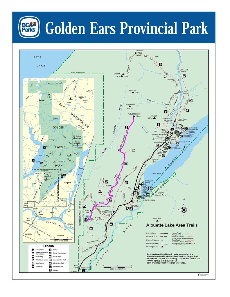
地图:
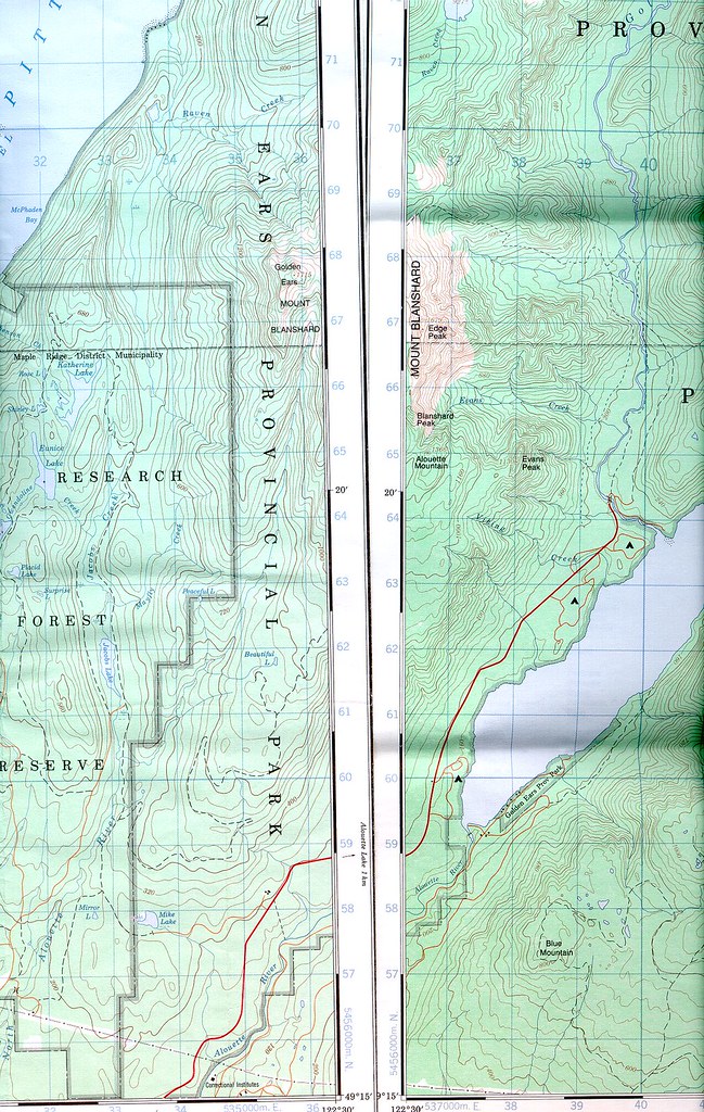
路线为图中紫红线所描:
驾驶路线:
Golden Ears
Provincial Park lies in the Coast Mountains 11 km north of Maple Ridge on the
north side of the Fraser River. Access to the park is by vehicle via Highway 7
or Dewdney Trunk Road through the Municipality of Maple Ridge. If heading west,
turn right onto 232nd and if heading east, turn left onto 232nd; then turn right
onto Fern Crescent and follow road into park. The closest communities, towns and
cities are Maple Ridge, Mission and Pitt Meadows.
抱着每参加一次,就在103上划去一个勾的想法,参加了lulululu组织的Alouette Mountain
hiking。没想到参加的个个如出山猛虎,速度快,中间也不怎么休息,刺溜刺溜往上赶,俺气喘吁吁的赶在最后面,勉强跟上。103上标明需时9个小时,我们这个队伍在山顶慢慢悠悠带了个把小时,下山狂采蓝莓又花了半个小时,这样的话总共也才花了9个小时,实在是生猛啊。整个trail虽然比较长,可是有很大一部分是logging
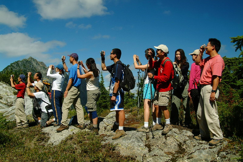
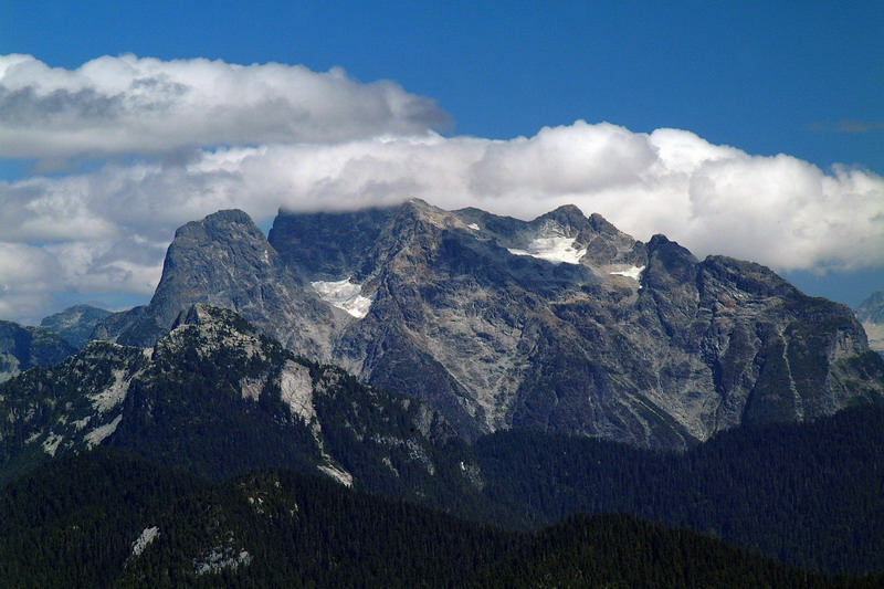
road,这也是走得比较快的原因之一。蓝莓奇多,吃得肚子都撑了。一路上都在林子里,一点儿也不晒,代价是什么view都没有,但是到了山脊上风景还算不错,360度风光。
|
摄影大队 :)
|
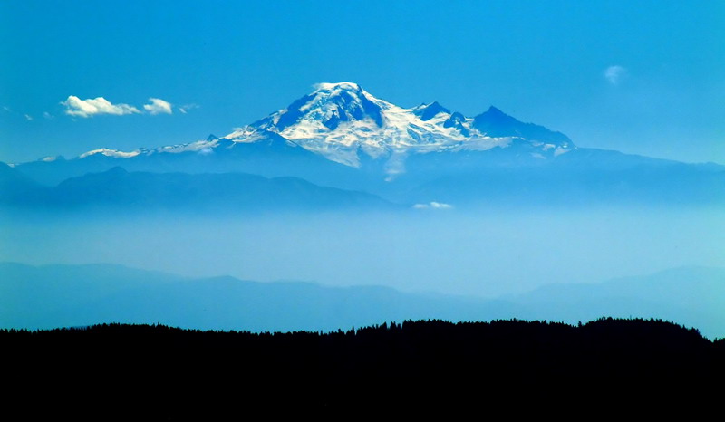
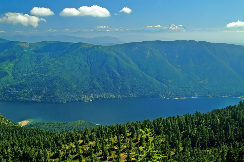
云雾绕山梁
Mt.Baker
Alouette lake
|
