|
雨中brandywine meadow hiking |

|
|
页面 1 / 4
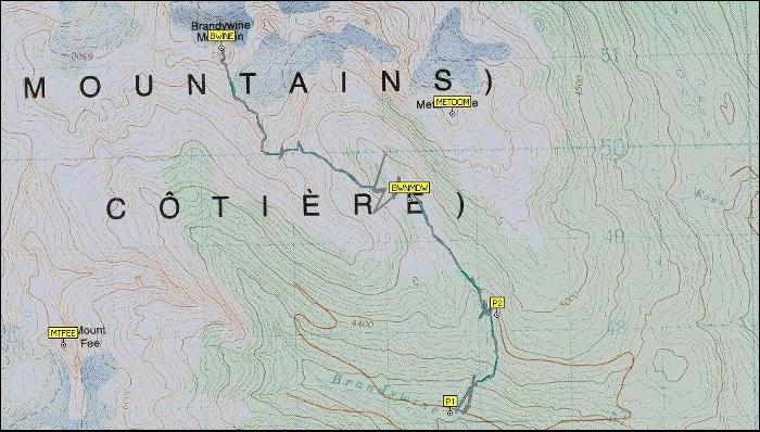
Trail名称:Brandywine Meadow + Brandywine
Mountain
Trail长度:6km+6km?
Trail难度:中等+难
Trail海拔最高点:1500m /
2210m
Trail的拔高:550m / 1270m
预计耗时:4.5小时 / 9小时
相关链结:
http://www.ece.ubc.ca/~ianc/BrandyWine2/
http://www.trailpeak.com/index.jsp?cat=hike&con=trail&val=527
驾驶路线:
Zero your odometer at the Cleveland Avenue traffic lights
in Squamish. Drive north on Highway 99 towards Whistler for 44 km. Less than 3
km past Brandywine falls provincial Park, turn left onto Brandywine Forest
Service Road. Shortly after leaving the highway the road branches; stay left.
Follow this road up the valley for 4.6 km to a three-way fork, where you may
pause to enjoy the striking view of the jagged peaks of Mount Fee directly
ahead. From here you take the middle road,BR10,for another 2.1 km, continuing to
ascend. If your vehicle can handle the road condition, you may drive as far as
the trailhead, a distance of 6.7 km from highway. Otherwise park whereever you
can
Driving distance from vancouver 120 Km
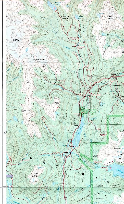
maps:

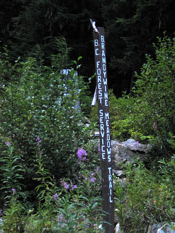
Trail 入口的牌子:
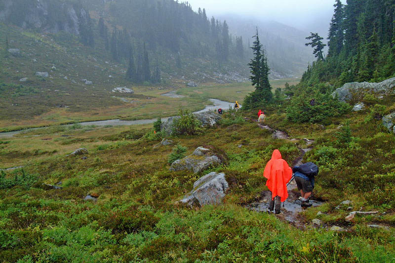
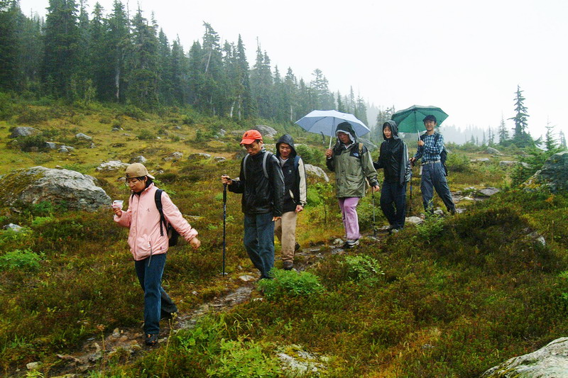
9月3日,一行30余人在枫下客的带领下来到brandywine meadow
trail的停车场,很多人抱着冲顶看冰川的雄心,枫领导甚至还带着头盔和冰镐。
可惜天空不作美,到了停车场已经开始淅淅沥沥地下起了小雨,而且或大或小,一直到我们最后一组下山,都没有停过。开始沿着树根盘绕的trail上行,本来就泥泞湿滑,而且出师不利,不小心捅了一个马蜂窝,很多hi友不幸中弹,有的伤势严重。经过两个多小时缓慢地爬行,终于来到第一站brandywine
meadow,雨却一点儿也没停。
到了meadow,
有的已经被淋得瑟瑟发抖,有的却觉得不过瘾,还想冲顶,于是队伍分裂,剩下14人的冲顶队。这时已经是下午1点多了,实际上冲顶时间已经不够。抱着走多远是多远的想法,继续前行。冲在最前面的沿着有石头标志的看起来明显是trail的道路直往前冲,沿着一个乱石堆山谷就往上爬,实际上和事先研究的向左的道路不同。不过山顶全是大雾,即使是正道,一来也到不了顶,二来上去啥也看不见,所以大家就继续沿着这个无名山谷上行。到了山谷顶端,进了大雾,一片白茫茫,终于决定到此为止,合影留念。等我们回到停车场,已经是6点多钟了。
这一次天公不作美,没有欣赏到brandywine
mountain 的壮丽风光,没有踏上冰川,下一次我们一定会再来。
来到meadow
走出树林
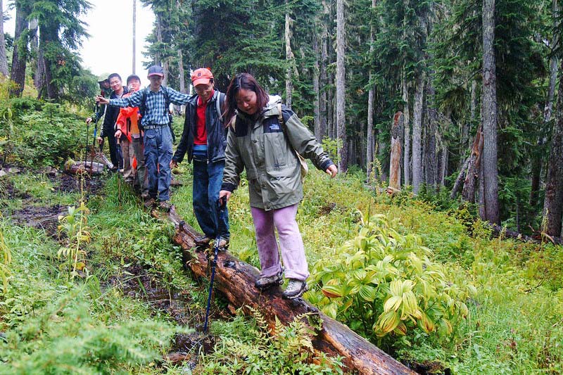
独木桥极为湿滑,两边沼泽危机重重
|
